Here’s something I wrote a few years ago, and that website is now being closed down. Thought I’d post that info here…quite a long post.
The Nebraska‐Mayflower Connection
My Genealogical Field Trip to the Hopewell Presbyterian Church Cemetery
Mark Allen Cross
January 2014
It was a little over a year ago that I discovered I have ancestors that trace back to the Mayflower. I made this discovery by finding a photo of the gravestone for Ruth Ann Smith Reed in Nebraska, my 3rd great grandmother. Ruth Ann Smith Reed is the great grandmother of Thelma Reed Rosemarynoski, who we call Grandma Rose.
Her Find A Grave memorial is here
I was fortunate to be able to make a road trip to the gravesite in December 2013. Jena and I travelled to Omaha, Nebraska to visit her family for the holidays. The cemetery is about a one hour drive from Omaha. It was windy and cold at 12°F that day, so very chilly! A good coat and scarf with gloves was necessary, but the trip was well worth it!
Cemetery information, including directions and a map, are here
In the above link, you can do a search for the surname Reed or Smith and see everyone with that last name that is buried there.
I drove the rental car to Unadilla, Nebraska, which was all main highways to that point. I drove through the small town of Unadilla, thinking I would follow directions and drive 1 mile west then 5 miles south. I drove the 1 mile west, and once I turned to head south, there was a large sign that said the bridge was out ahead. So, I backtracked to the town, and decided to try 5 miles south, then 1 mile west. That route worked fine. I crossed a small one lane bridge that
went over a creek. Although the creek is small, over the years it has carved a deep enough ravine in the earth that a bridge is quite necessary.
The roads once I left town were all gravel farm roads, spaced one mile apart like a patchwork grid. Driving a mile is easy, it’s just the next road a mile away. I set the tripmeter to make sure I was following directions. The roads travel through farmland, surrounded by lots of cornfields and other crops in Nebraska. It’s rarely travelled; in the 12 mile roundtrip and the 1½ hours or so including time and photos at the cemetery, I only saw one other vehicle, a pickup truck driven by a farmer.
Just as the directions indicated, the church and cemetery are on the SE corner of the intersection. The photo of the Hopewell gate on the Find A Grave website is the entrance to the cemetery. The gate was closed but unlocked. You drive down a slight incline, over a ditch, to get there and just open the gate. I parked inside the cemetery on the grass to avoid parking on the side of the road and maybe blocking traffic. A needless concern, as it turned out. But I felt safer parking off the road.
The Hopewell sign over the gate indicates the cemetery was founded in 1880. Ruth Ann died in 1881 so is one of the first graves in the entire cemetery. Her grave and the group she is in is near the top of a small hill.
The photos on Find A Grave do not paint a clear picture of how the graves are arranged. Each photo is of an individual grave. There is actually a group of graves together, all near a tall granite memorial marked M. G. Reed, the husband of Ruth Ann. Other family members are buried together.
There are several other Reed and Smith graves that are not part of the group, and can be found using the surname search mentioned above. This PDF is mostly photos of the MG Reed group, including his wife Ruth Ann Smith.
The photos that follow paint the picture of those graves in a more clear manner, and also show photos of the church and surrounding countryside. I share these photos in this PDF document because I was fortunate to travel there, and not everyone will be able to see it in person.
This PDF is online as part of my website, but can also be downloaded or printed as you see fit. Enjoy!

Figure 1 ‐ The 6 Graves together in a group; the tall memorial is not a marker for an individual grave.

Figure 2 ‐ The 1st two graves on the left Dwight died as an infant. His Find A Grave memorial is here
Walter died as a young boy. His Find A Grave memorial is here
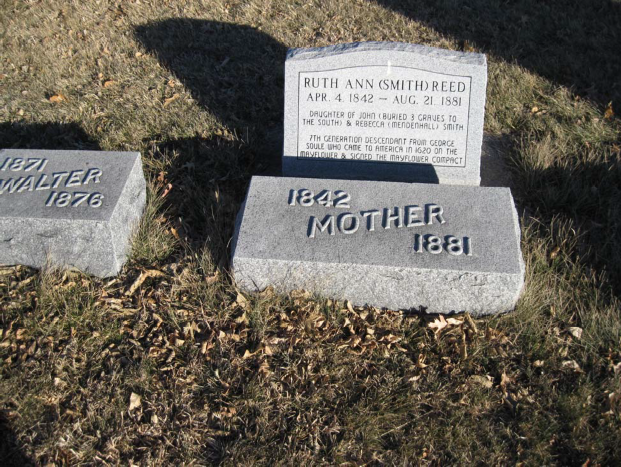
Figure 3 ‐ The 3rd grave from the left, Ruth Ann (Smith) Reed
Ruth Ann Smith is our connection to the Mayflower. Her Find A Grave memorial is here
The Find A Grave memorial includes a close‐up of the Mayflower stone, which was added a few years ago by another distant relative.
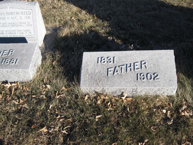
Figure 4 ‐ The 4th grave from the left, Matthew Gooding Reed, husband of Ruth Ann Matthew Gooding Reed is named “father” on his gravestone. His Find A Grave memorial is here
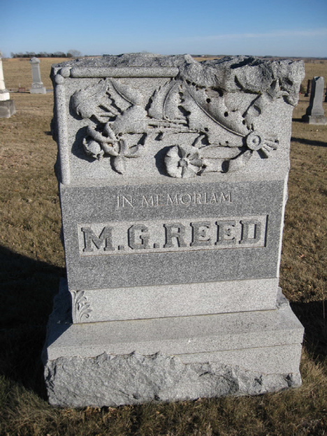
Figure 5 ‐ The memorial stone for M. G. Reed
This large memorial stone does not mark an individual grave, but rather the Reed/Smith group that is buried together.
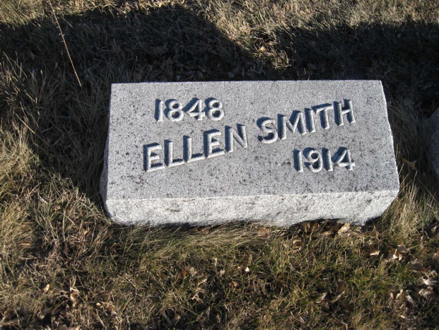
Figure 6 ‐ The 1st stone to the right of the MG Reed memorial, Ellen Smith.
Ellen Smith is the sister of Ruth Ann, and sister‐in‐law of Matthew Gooding Reed. There is no record that she ever married or had children. Her Find A Grave memorial is here
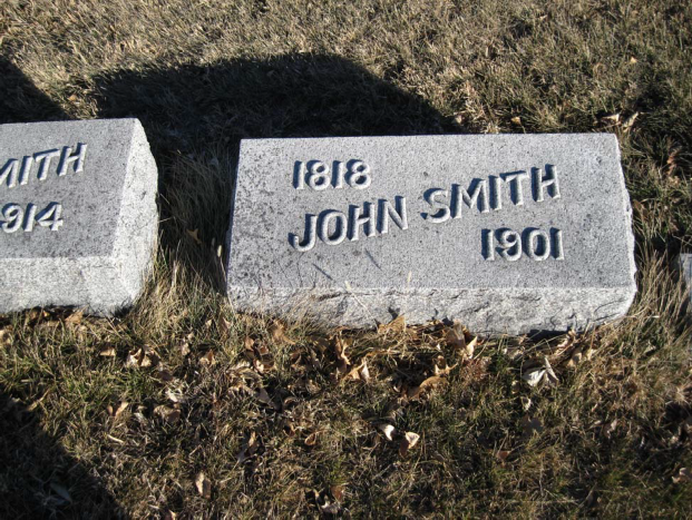
Figure 7 ‐ The last grave on the far right, John Smith
John Smith is the father of Ruth Ann and father‐in‐law of Matthew Gooding Reed. His Find A Grave memorial is here
John’s wife, and mother of Ruth Ann, is Rebecca Mendenhall. She is buried in Kansas. Her Find A Grave memorial is here
There is currently no photo of Rebecca’s actual gravestone and it is not yet confirmed she is actually buried there. A Photo Request for her gravestone has been submitted to Find A Grave, and volunteers in the area usually do a pretty good job of taking photos if they live close by. This Photo Request was submitted by me some time ago and has not yet been fulfilled.
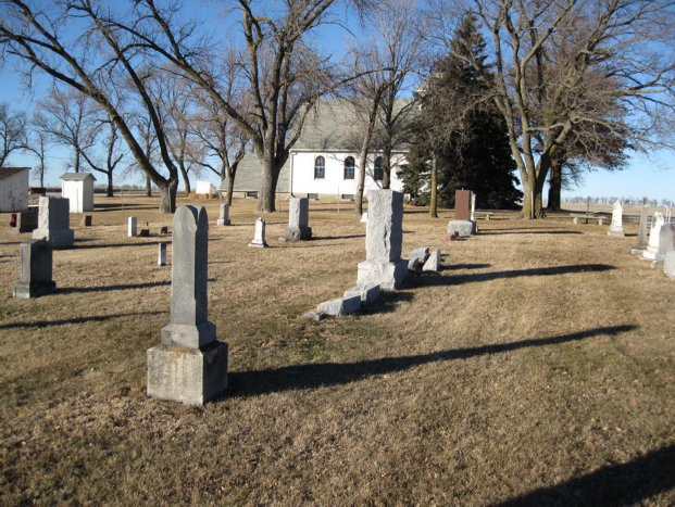
Figure 8 ‐ The Reed/Smith group from the side, with church in background
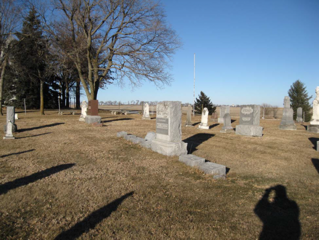
Figure 9 ‐ another view of group, church is on the left in background, near the trees
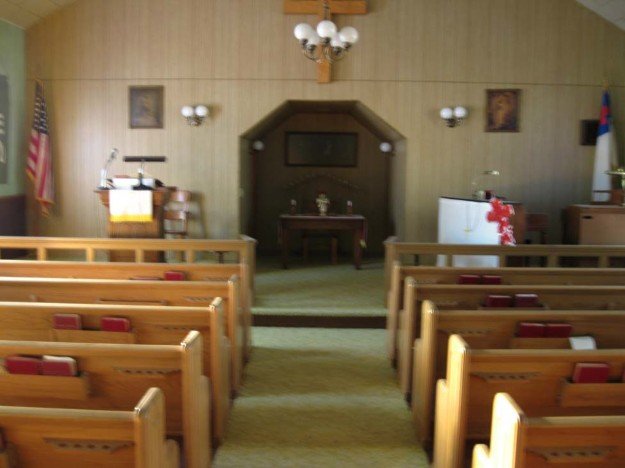
Figure 10 – inside, looking from the back of the church
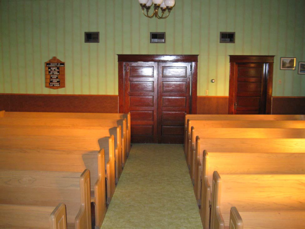
Figure 11 – inside, looking from the front of the church towards the entrance
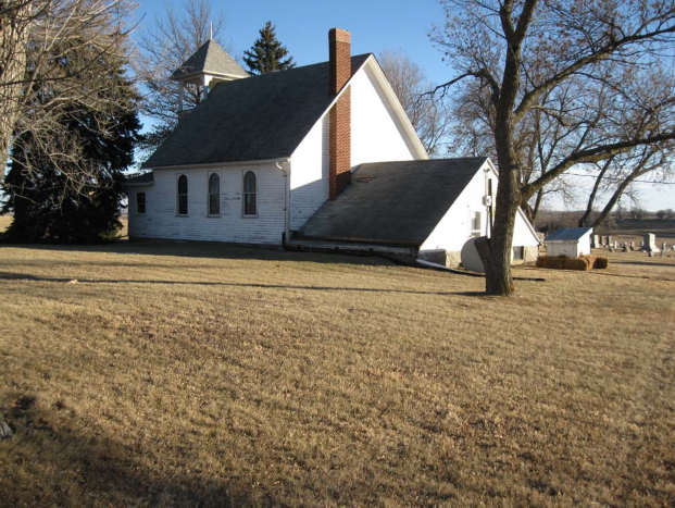
Figure 12 ‐ the NW corner of the church; the lower roof appears to be a living space “apartment” area that may or may not be inhabited
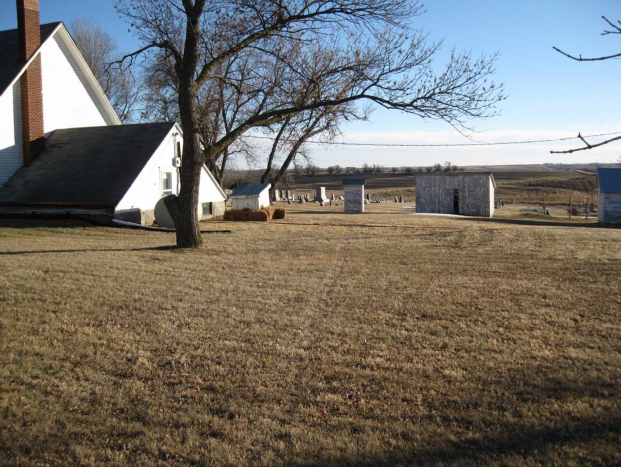
Figure 13 ‐ from the NW corner, with garages, sheds, and other outbuildings nearby, and cemetery in the distance
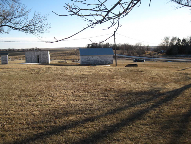
Figure 14 ‐ a view just to the right of previous Figure 13, rental car I drove is just inside cemetery gate near road
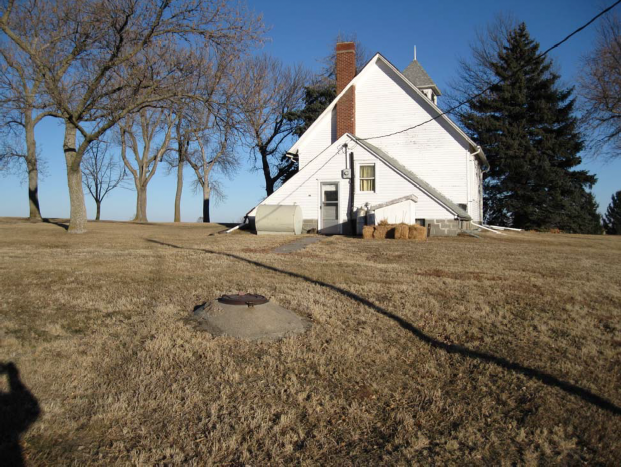
Figure 15 ‐ another view of the living space “apartment” that was possibly a Pastor’s living quarters at one time. Note concrete mound with iron lid; close‐up in next photo.
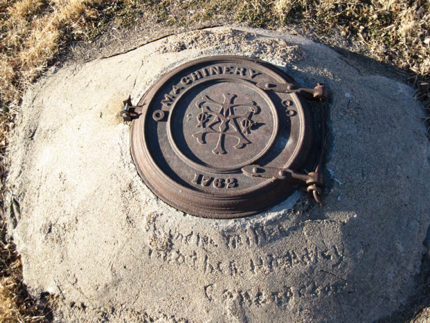
Figure 16 ‐ Have no idea what the Machinery Co. is or where it was located. Year of 1762 is quite fascinating! Probably this lid was brought to Nebraska from one of the original colonies back east.
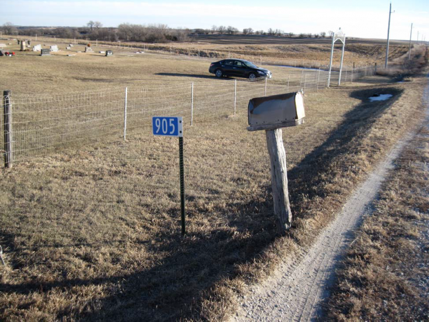
Figure 17 ‐ another view of the gate and my rental car
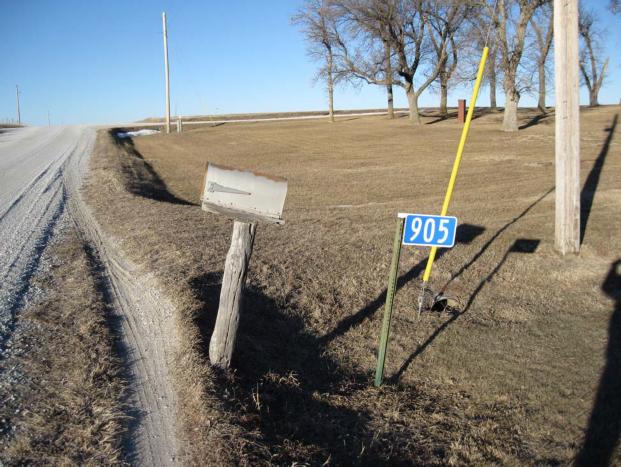
Figure 18 ‐ SE corner of intersection, looking straight north
This was quite a fun little field trip! Other than the cold and the wind, it was very enjoyable!
If you ever get a chance to travel there yourself, the driving directions online are quite simple. Hope you had a nice little trip from the comfort of your own home!
Mark